03 — The land
Land, river and map
Flat alluvial ground on the left bank of the Chenab, about 200 metres above sea level, in the Jech doab country between the Jhelum and the Chenab.
The river
The Chenab
The Chenab is formed where the Chandra and the Bhaga meet at Tandi in Himachal Pradesh, and runs some 960 kilometres before it is joined by the Jhelum at Trimmu and later by the Ravi. Its waters were allocated to Pakistan under the Indus Waters Treaty of 1960, and it feeds the canals that this district lives on.
The name is read as chan-aab, the moon river. It forms the boundary between the Rechna and Jech doabs, and it is the reason the belt of villages here is called the kaddhi — the villages along the bank.
The setting
Administration
| Province | Punjab |
|---|---|
| Division | Sargodha |
| District | Sargodha |
| Tehsil | Kot Momin (since 2003) |
| Elevation | about 200 m |
| Postal code | 40471 |
| Time zone | PKT (UTC+5) |
| District area | 5,854 km² |
| District population (2023) | 4,334,448 |
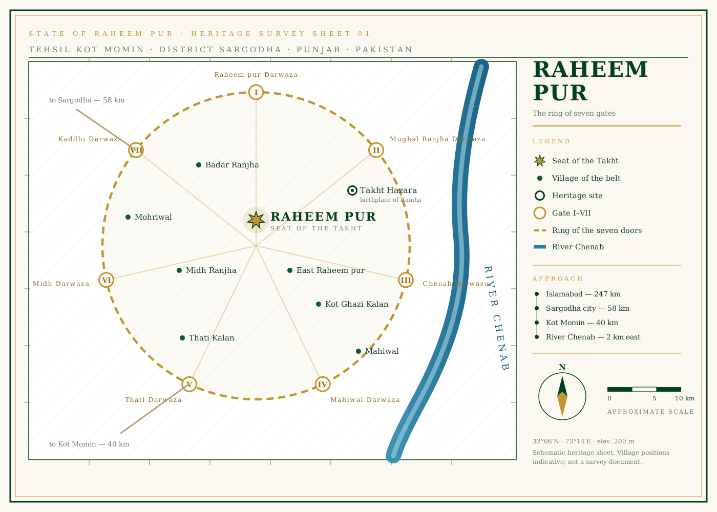
Around the circle
The villages of the belt
East Raheem pur
The southern extension of the settlement itself.
Kot Ghazi Kalan
Immediately south; one of the villages counted around Midh Ranjha.
Midh Ranjha
The central village of the cluster, 21 km from Kot Momin, and the home of Heer in the story.
Takht Hazara
The old town on the bank; the birthplace of Ranjha, once called Khajjiyan Wala.
Badar Ranjha
North of the circle, in the same Ranjha country.
Thati Kalan
To the south, on the road down the bank.
Mahiwal
South-east, carrying the other name from the folk story.
Mohriwal
West, out on the farmland side.